 |
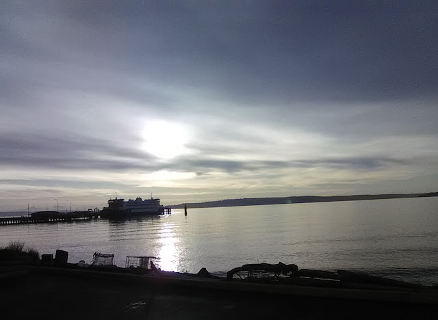
| Port Townsend sunrise |
 |
| Deer through the window at breakfast. This may have surprised me nine months ago! |
 |
| I take crap-tastic pictures when I'm chatting :D Harlequin Ducks, at any rate, have returned! |
 |
| Port Townsend sunrise |
 |
| Deer through the window at breakfast. This may have surprised me nine months ago! |
 |
| I take crap-tastic pictures when I'm chatting :D Harlequin Ducks, at any rate, have returned! |
 |
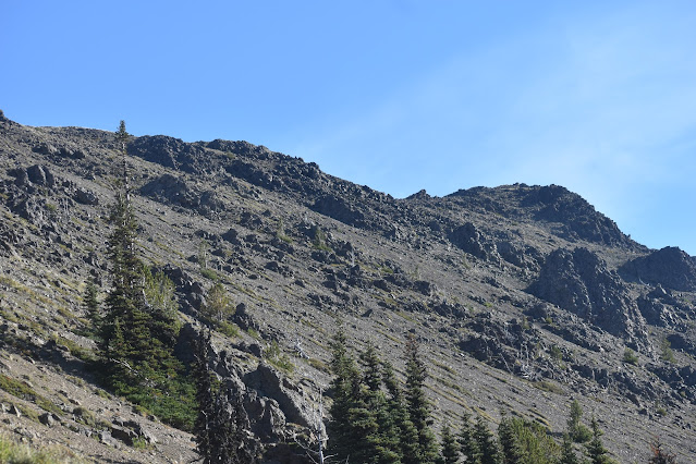
| The rocky slopes of Buckhorn Mountain from Marmot Pass |
 |
| A shelf for my coffee - very welcome discovery |
Need to catch up on your sleep? Camp in September in a place that doesn't allow you to build fires. Half the day is dark, and your sleeping bag is the most comfortable place you can find. I made one necessary trip outside of my tent around 4 AM, and then slept until civil twilight (that lovely time before sunrise when you can see well enough to walk).
Getting out of my tent for breakfast involved a lot of slow decision making. I was sore from the hike up, and honestly didn't want to get out of my tent and stand up if there were still things inside my tent that I needed. No more squats. Once I'd chucked out those important items, I got out of the tent and strolled over to the spot where I'd hung my food bag. It was still there, unmolested. Phew!
I got my coffee and oatmeal out, as well as my snacks for the morning hike, then searched the grounds for a better branch for hanging the food. It may not have been super-necessary in this semi-open habitat, but better safe than sorry. I found a tree with some higher branches, although they didn't extend far from the trunk. On throw number one, this was the outcome:
I briefly wondered how getting it down was going to go. . . but was otherwise happy with the outcome. I packed things up in the misty morning, rolling up my sleeping bag and pad. My intention was to set out from camp, head up from my camp (5300 feet) to Marmot Pass (5950 feet) in a little under a mile. I'd have a couple hours to poke around up there before coming back to have lunch, pack up, and return to the car.
 |
| The start of the hike - I brought no sunscreen, although this was only a mild regret by the end of the morning. Incidentally, I had *no* bug problems on the entire trip. |
 |
| Buckhorn Mountain from the trail |
Heading out of camp, I realized that there are actually quite a few campsites at Mystery. Heading up in September on a Thursday, I'd had the entire place to myself, but I could imagine it filling up in other seasons. Varied Thrushes and Canada Jays were common on the hike, and early on I also got a new species for the year list - Pine Grosbeak! (187 for the year, a tally I'll keep adding parenthetically) The bird was out of sight but gave several of its cheerful warbling calls before taking flight.
These trips, mind you, have been undertaken with a sense of humor. Yes, I'm hoping to find two hundred species by the end of the year. Yes, when I hiked up Mount Townsend with my son and nephew and found no new species, that did not help me towards my goal! But. . . I got up Mount Townsend with my son and nephew, so the goal helped me towards what I really want - joyful exploration of this beautiful state.
Keeping that in mind, there was a list of birds that were possible adds on this trip:
Clark's Nutcracker and Pine Grosbeak - I saw both as likely.
Gray-crowned Rosy Finch, Townsend's Solitaire, Mountain Bluebird, Golden Eagle - I saw as less likely but possible.
Ruffed Grouse - I saw as a bird I'd missed for the year. Easier in the spring when they're drumming, or in the mornings on gravel roads, especially on the west side of the county. Here I was on the east side, and probably with these birds hidden all around me!
 |
| Canada Jay |
If I came back from the trip with two new species, I'd probably be on track to fall just short of my goal. Three? Now the goal would still feel in reach, so I needed some good surprises. lol "needed". . . you know what I mean.
As I slowly ascended, I enjoyed the comfortable morning, and I started to get views of Buckhorn Mountain peeking out from behind the trees. The path took me to a large meadow at one point, apparently this is the home of the marmots (Olympic variety here), which live in burrows, and sometimes come out onto large rocks to enjoy the sun and the scenery. I didn't see any on the trip but enjoyed the *idea* of them perched on the rocks. I could, at any rate, hear the first human voices since I left the trail the afternoon before - campers up on the ridge ahead.
 |
| The low easy path to Marmot Pass is visible here. |
I hit a little spot that looked campsite-ish, and there were two paths leaving it. One going up the ridge directly in front (west) of me, and the other heading parallel to the ridge (north). I sighed as I looked ahead to the ridge but tried to put the steep direct climb into perspective. I'd been up and down many flights of stairs earlier in the week as I moved my daughter into her college dorm. I could do this.
 |
| I took that path instead |
Amazing view! I was a little puzzled, trying to figure out if I'd made it to Marmot Pass, but I just took a few pictures regardless. From there, I continued along the ridge to the voices I'd heard. They belonged to a couple of mountain goats. Not actual goats, but two older guys who had been backpacking for several days up here, and who seemed completely at home.
It was fun to chat with them for a bit, to talk about their trip (which included Constance Pass the day before), and eventually about birds. Pine Grosbeak and Clark's Nutcracker both came up as birds that they'd seen and heard on the trip. This gave me some hope!
 |
| I had to at least get the picture of his hat This Chimacum grocery is highly recommended |
As I wrapped up the conversation, one of them suggested a little side trip. "See that rock over there?" I nodded. "You really should head over there. Great spot to have lunch, and the views go all the way down to Port Angeles." "Yeah, but. . . " I gave him a look that communicated, "Dude, I'm still feeling lucky to have made it up here and am not sure I want to push my luck." "I understand." he said, fully understanding, "but seriously, it's not a hard walk.
I considered this as I started down the north end of this ridge, ending up at the "road signs" at Marmot Pass. It was such a nice morning, such a great open spot. I just sat and sipped some water, nibbled my snacks. It was 9:30 something, and I decided to see how I felt about the northward trail by 10 o'clock. Clouds sometimes drifted up towards me at the pass, but for now they balked at cresting the pass completely. It was fun to see clouds doing the same thing on the far side of the valley (the Copper Creek Valley? I think so).
 |
| Osprey in migration over Buckhorn |
 |
| The trip up. You can see trails crossing at Marmot Pass below |
Ten o'clock arrived, and I felt good. I took the trail north in the direction of the rock I thought the old fella had been pointing at. Along the walk, I got another. . . expected surprise? Sure. A Clark's Nutcracker (188) flew past silently. Is it weird to be disappointed at a seen-only bird? So many birders will note that a bird has been "heard-only" if they don't get to actually see the bird. The supposition is that without visual confirmation, identification becomes tricky. In many cases, this is true, but this is a bird with such a cool, distinctive call - a harsh nasal call that I automatically associate with high and dry habitat.
The views slowly improved, especially to the south, where Warrior Peak started to peek out. Then I got to a parting of the paths. One went straight ahead, and one angled upwards. I looked up and thought I was looking at the rock that I'd seen earlier. I debated it a little bit and decided to take the upward path. So that's how I ended up accidentally going halfway up Buckhorn Mountain, just for clarity.
 |
Things got very talussy... talusful? There was talus. Loose rocks that sometimes meant the loss of some progress as I went up. Once or twice, I got a little off trail, but rejoined it, keeping an eye on the rock formation ahead. As I went up, it was also fun to look back at the marker for Marmot Pass, appearing lower and more distant over time.
I honestly almost got to the rock in question, but at this point, I could start to see around the corner, and the valley was full of thick clouds below. My hopes for actually looking out at the Strait of Juan de Fuca were not great. I stopped to breathe for a minute before heading down and got my first *real* surprise of the day, a Gray-crowned Rosy Finch! (189) There have been sightings up here, but most of the descriptions had placed the birds in the talus on Buckhorn Mountain - something I of course had not planned to climb. Haha. Ha.
And then as I started down the hill, I nearly bought the farm on the first step I took. The rocks gave way under my step, and I regained my balance. I stopped, steadied myself, and thought about how lucky I was that I hadn't gone tumbling down the slope. The second step that I took? Exact same thing. Goodness.
 |
| Far enough |
So, this essentially became my morning wordle. My brain, presented with the fact that I had to map and plan out every step on the way down, got engaged in a happy familiar way. Honestly, despite memories of someone breaking a leg on talus on a hike with me many years ago in the Olympics, this was a lot of fun.
I got into a good routine, finding big rocks, when possible, for sure footing. No big rocks? I looked for plants. Neither? I looked for medium sized rocks, and kind of . . . surfboarded them, for lack of a better term. I'd push them down and push forward, letting the rocks slide, but also bringing a lot of rocks up in front of it. No medium rocks, and I'd just scan ahead to my next secure footing, then let my shoe be the surfboard, pushing it down at an angle, so that rocks would build in front of it as I slid down a little.
That was pretty tedious, I understand. But I've gotten very interested in what hiking does to my brain. I'd love to see brain scans in *all* of the following situations. I know it's not possible, really, but I know it'd be interesting and different for each:
 |
| Golden-crowned Sparrow, offering no directions |
 |
| Chestnut-backed Chickadee, checking on my well-being at Camp Mystery |
"Choosing" a date (Sudoku)
 |
| Name that fungus? I cannot! Upper Big Quilcene Trail (update! This is Bear's Head. It's edible, choice, and has no real lookalikes) |
 |
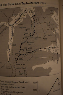
| From a 1995 Falcon guide (Hiking Olympic National Park by Erik Molvar) picked up at Goodwill for $3.99. Great purchase. |
But. . . finding mutually available dates was a downfall, and I needed to figure out a solo solution. Obligations and opportunities with work and kids narrowed things down more and more until, just like a Sudoku puzzle, the date was decided by process of elimination! I'd also already gone up Mount Townsend in August at this point, so this was my plan - Go up to Camp Mystery on the 19th. Camp. Go up to Marmot Pass in the morning. Bird. Head back to camp for lunch and return to the car.
Getting there - Point no Point (Connections)
I'd been working in Tacoma on Wednesday night, and decided to do a hotel stay in Tacoma. The tiebreaking fact was a hot buffet breakfast. In advance of the hiking, I'd take any calories I could get!
 |
| Sunrise from my room |
 |
| That stupid "Ford Hawk" Fool me once, shame on you Fool me a dozen times. . . um. . . |
For Kitsap, since it isn't the primary focus for the year, the goal has just been 150 species for the year. It being September, a lot of birds are passing through, but I also saw one of the birds on my "not-going-anywhere" list. Virginia Rail! This list was getting shorter, but I've been keeping a close eye on it, figuring that I could at least *try* to find these birds any time. They range from Red-breasted Sapsucker to American Dipper to like. . . Mountain Quail. Crazy to think that there *are* Mountain Quail in Kitsap every dang day, and that they'd just be a commitment to try to find them doing their daily business.
 |
| Dedication |
So, I parked in the boat launch area and did the walk to the lighthouse along the beach. I'm going to admit, I was without my binoculars. I assumed this was because I'd left them at home, but they were actually in my car - just tucked in the back of the trunk following some Holy Reckoning with the space in my car when I was moving my daughter into her college dorm. I figured I'd try my luck with just the scope and camera.
 |
| Common Tern |
On the way to the lighthouse, I thought I spied an interesting gull and snapped some pictures. I honestly didn't realize I'd caught a Common Tern until I got home and looked over my pictures! 143 for the year in Kitsap, and *not* one of those birds that's around at any time of year.
 |
| Photo showing the distinctive black shoulder mark that helps rule out Arctic Tern |
I got to the lighthouse, where there were a couple dozen people fishing, and one person birding.
"Anything good?"
"There was just a Sterna Tern in with the Bonaparte's Gulls!"
*pause* "Pardon?"
"Sterna Tern - like an Arctic or a Common." (I need to learn more of my genera!)
Soon, we were watching a Parasitic Jaeger (144) harassing the hundreds of Bonaparte's Gulls. Two more passed by as we chatted about birding. This relatively young birder had his sights on getting to every county in every state in the US! I have some ambitious goals inside the state, but this is something else! His rules: An ebird checklist in each of the counties - no incidental lists, all full lists.
 |
| Parasitic Jaeger bullying some Bonaparte Gulls :) |
He's done with some states already and is moving to Texas soon! Fun especially to talk about the different ways that goals like this can move us towards something that we can call fun. I'd really not enjoy doing it the way he's doing it. I'm sure he'd not enjoy my methods either! It's always my question before embarking on a year, during a year, and after: "Do I like what these goals are making me do?"
It's been a mostly solid yes for me in these years. I like the depth this has given me on each county in the state. Last year, taking on four counties was a bit too much! But just a little. That decision is going to make me go back to those counties for quite a few missing birds to get them to 175. I don't mind doing that, as long as I don't leave *many* counties that far off.
 |
| Surf Scoters |
I snuck away to the marsh behind the lighthouse. The seep and chip and smack notes around me sounded like five or so species of sparrows (junco, towhee, both -crowned Sparrows, and Song. Actually... maybe Savannah too, make that six). But I got right into my Virginia Rail call. It's one of the stupidest things I do (that's saying something), but it often does the job. It did today, as a Virginia Rail (145) grunted back from the marsh.
It was nice getting to make this connection for an hour or so. There had been quite a few over the course of the last couple of days - crossing paths with birders I've known for many years in Renton (where a Pacific Golden Plover dropped in for a visit!), and with a birder that I have not seen in many years in Tacoma. In the pursuit of bird species, we keep track of life lists and year lists. I added some birders to both of my lists this week.
Getting there - Upper Big Quilcene Trail (Cross words)
 |
| A backpack from the beforetimes |
The meandering lost me some time, and I took a little more time to do my final bits of knots and whatnots on my pack. I started the hike at a quarter to three, with sunset about four and a half hours away. I had 4.8 miles to hike. I did the math on this in my head and hit the trail.
First off, I literally cannot tell you how many different kinds of mushrooms I saw on the trail. (I don't think I've used literally before in any of my blogs?? Either way, enjoy that fully intentional use of it). It's not just that it was a hand-wavingly large number. I just don't know what I'm looking at. But here's a quick gallery.
 |
| Better dinner idea! Blueberries on the trail |
Stopping to take mushroom pictures was one of my dedicated strategies for surviving this hike. I think on hikes where I've pushed things, it gets a little sketchy. I still had sunset on my mind but wanted to make sure I still had gas in the tank by the end.
The trail was pretty reasonable, all in all. Steep at times, but this always seemed to be followed by stretches of flatter hiking. The more challenging pieces were ones where I had to cross streams. Most pretty easy, but one more challenging. I got almost all the way over and decided to grab hold of some foliage to steady myself. Oops. Devil's Club. It drew a tiny bit of blood, but nothing I couldn't survive. I was just glad to have not ended up in the stream.
Some things I *did* know I could eat, and I did: Thimbleberry, huckleberry (red and purple) and salal. There were also some birds on the hike! Dark-eyed Juncos, Varied Thrush, Red Crossbills (above the canopy), and even a pair of American Dippers in the Big Quilcene.
 |
| American Dipper |
 |
| One of the wider crossings |
In addition to my pack, I was carrying my camera case. This felt a *little* silly, but there were some benefits. I didn't have to worry about cramming my camera into the pack or worry for its safety if I did a serious topple. The camera case provides some good padding. I'd also used the little compartments in it for other things. One held a nalgene bottle. One had my snacks. The zip pocket held a map. It was a good use of the small case, at any rate. I still may seek out options for reducing things on future trips. Not if these things become inaccessible!
Around an hour later (5:45) I heard a flicker call. I don't know why I noted it. I just knew, as the forest opened up a lot and I looked across the valley to the ridge opposite of the trail, that I *had* to be getting close. There were some more cross words as I kept running into yet another long ascent along the open ridge. On some stops of this steep section, I took off the pack, and even my shirt, just to let the shirt dry a little and to let my body cool down. It may only have been 60 degrees or so, but I was heated up enough for this to be pretty comfortable.
 |
| So much relief |
Another hour later (longer than I had hoped!) I finally got to Camp Mystery. I let out a good whoop - one that was not returned, as I had the camp all to myself on a Thursday evening. In twenty minutes, I had my tent up, a new change of clothes on, and water was boiling for dinner. Here, I'd splurged and gotten a ten-dollar backpackers' meal from REI. Zero point zero repeating regrets with this decision. It was so tasty.
I drank some of my water with it, carefully looking at the amount I'd brought, and thinking through the trip. One of several smaller purchases I made for this trip was a life straw filter and water bag. It was getting a little dark to fill it up right now, and I still had plenty of water, I thought. I knew that, ultimately, I'd want to use the large plastic bottles for things like coffee and oatmeal. I was unsure at the time about getting water into the pouch, filtered, and into a pot. Either way, I was good for the trip, given the fast-moving stream right next to my tent.
After dinner, it was getting dark. My friend had loaned me a bear bag for hanging my food. . . I just hadn't had much time to practice. Any. And the site didn't have the tree. In my head, I'd imagined a tree with a nice, long, bare branch sticking out about ten feet, for me to toss this bag over. So, gosh I did a bad job with the bag that night!
I got into my tent and fell asleep to the babbling creek. My brain kept telling me that I was hearing kind of crunchy sounds sometimes. In my head, I imagined the crunching of branches as the bear climbed the short distance up the tree. . . the crunching of my food as it tore open the bear bag. I tried to just stay relaxed about it. The bear spray sat outside of my tent, but. . .I was not going to clamber out of my tent and startle a happy bear in hopes of having a little confrontation. I just tried to sleep and stepped through Plan A (with food) and Plan B (without).
I did eventually drift off, warm in my sleeping bag on a cool night. I awoke once with moonlight bright against the foot end of my tent, then drifted back to sleep.
Port Townsend I woke up at the Harborside, finally feeling moderately well rested. The view out the window of my room was lovely - I may hav...
